Sediment Sources
Although sedimentation is a normal geological process, scientists have concluded that the rate of sediment supply to Lake Pepin has increased more than tenfold since the arrival of European settlers. It is now anticipated that the upper third of the lake will be unsuitable for recreation by the end of this century and the entire lake substantially filled within 340 years. Without the human-induced increase in sedimentation rates, Lake Pepin would be one meter deeper and expected to provide recreational and commercial value for another 4,000 years.
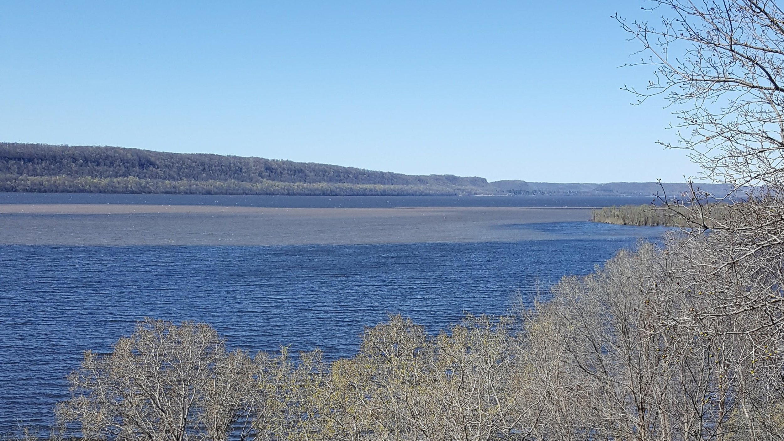
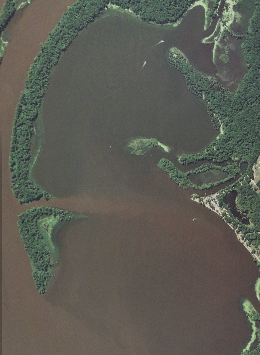
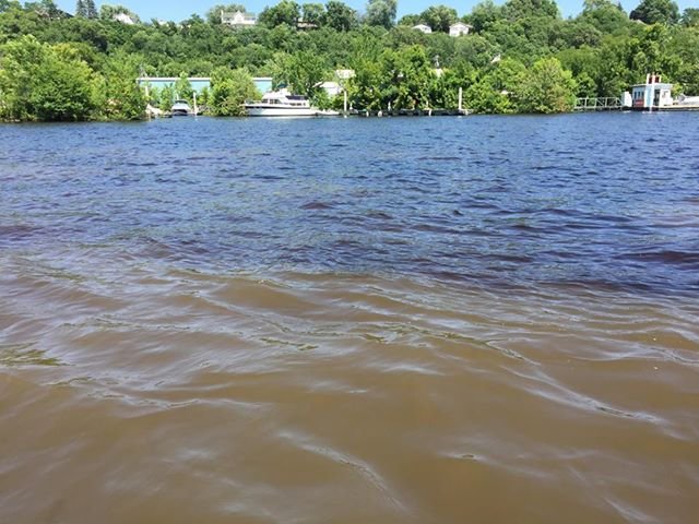
Lake Pepin is also threatened by excess nutrients leading to eutrophication and downstream impacts. Phosphorous is the limiting nutrient and excess input from the surrounding landscape has led to eutrophication, characterized by algae blooms that reduce light and oxygen thereby threatening animal and plant survival. It is estimated that the accumulation of phosphorus in Lake Pepin sediment has increased 15-fold since 1830. This eutrophication process is tightly linked with sedimentation because phosphorous binds to soil particles, which are transported together down the watersheds to Lake Pepin. Nitrogen input is also affecting local water quality with cascading impacts all the way to the Gulf of Mexico, where a large hypoxic area, or "dead zone", has formed at the Mississippi delta leading to environmental problems, such as fish kills.
The problem is driven by natural and human-induced processes throughout all of the major watersheds, which creates complexitiy as stakeholders collaborate on possible solutions. The Minnesota River Basin (MRB), however, is the main concern since it contributes 80-90% of the sediment accumulating in Lake Pepin. LPLA has partnered with government, academic, non-profit, and citizen stakeholders to raise awareness, increase scientific understanding, and implement projects to protect Lake Pepin. While most projects are directed at mitigating upstream sources of sediment and nutrients, LPLA is also leading management efforts to reverse current impacts already affecting the lake.
Sediment Sources

Although fed by five watersheds, 80-90% of the sediment entering Lake Pepin come from the Minnesota River Basin (MRB). The Le Sueur and Blue Earth watersheds account for a 1/5 of the MRB area, but up to 1/2 of the sediment to the Minnesota River. Up to 65% of the sediment comes from near-channel sources: streambanks, bluffs, and ravines. Upland sources, such as agricultural fields, account for the other 35%.
Multiple factors contribute to the MRB’s elevated sedimentation rate, including the natural geologic history, human land use changes, and climate change. Geologic processes started thousands of years ago continue to carve out waterways throughout the MRB, making the region highly susceptible to erosion naturally. Human land use changes since the European settlement have exacerbated the natural erosion at upland and near-channel sources. And now, climate change is altering precipitation patterns and leading to higher, more erosive streamflows. This more nuanced picture of the landscape is extremely important for effectively exploring and prioritizing action steps to address the sedimentation problem. Protecting Lake Pepin will require management efforts aimed at upland and near-channel sediment sources as well as the underlying driving factors:

A diagram showing how agricultural tiling has contributed to higher pollution runoff and increased streamflows. In the top picture excess water is immediately channeled into nearby waterways. In the bottom picture, surface water is naturally absorbs into the soil and permeates to waterbodies gradually. The natural process removes pollutants, including soil particles, and reduces the erosive force in streams. (Source: MPCA)
-
The geology and glacial history of the MRB has an unique role in watershed erosion and downstream sedimentation. The Minnesota River Valley was initially formed by the torrential drainage of Glacial Lake Agassiz around 10,000 years ago. The MRB landscape as a whole includes relatively flat upland areas and specific points of sharp elevation drop, called incision points, or “knickpoints,” where the glacial meltwaters initially formed waterfalls. The Minnesota River and its tributaries have been continuously carving out ravines at these migrating knickpoints for around 10,000 years. In fact, scientists have determined that the tributaries of the MRB are some of the fastest downcutting and thereby rivers in the world. In terms of sediment production, the knickpoints demarcate the MRB’s landscape. Above them, in the flatter upland regions, soil erosion from agricultural fields is the larger source of sediment to the Minnesota River and its tributaries. At or below the knickpoints, the majority of the sediment comes from near-channel sources, specifically bluffs and ravines (Gran et al. 2009).
-
Prior to European settlement, the MRB landscape was dominated by prairies with fine, glacially derived and poorly drained soils, and dotted with “pothole” wetlands that were seasonally or perpetually saturated. The settlers recognized the tremendous potential of these fertile lands and began dramatic land use changes that involved large scale row crop production, extensive wetland drainage, and installation of artificial drainage networks or tiling. Together, these human-induced changes to the landscape have profoundly altered the hydrological processes and lead to increased streamflows with higher erosive force.
Agricultural production has nearly converted the native prairie landscape. By 2006, approximately 78% of the MRB landscape was covered in agricultural row crops. Leaving croplands bare in the off-season, as is common agricultural practice, has dual negative effects. First, it makes fields more susceptible to erosion and the transportation of sediment to area water bodies. Second, it increases field runoff and thereby exacerbates high streamflows that greatly increase the amount of near-channel erosion.
Maximizing crop production required adequate soil drainage. Prior to current hydrological understanding, farmers were actually incentivized to drain wetlands and install drainage systems, such as subsurface tiling, that would get water off the land as quickly possible. While drainage systems are highly effective in boosting crop productivity, they have the unintended consequence of increasing streamflows and thus contributing to the complex sedimentation problem we now face. In a recent study surveying 21 Minnesota watersheds, seasonal and annual water flow has increased by over 50% since 1940, with artificial drainage identified as the largest contributor (Schottler et al., 2013). Similarly, the MPCA has determined that the average streamflow in the MN River near Jordan, MN nearly doubled when comparing the period 1977-2013 to 1935-1977. These numbers point to a dramatic increase in erosive force and soil loss at near-channel sources. As would be expected, many agricultural watersheds of the upper Midwest share a strong correlation between increased streamflows, streambank erosion, and channel widening.
-
Climate change is altering temperatures and precipitation, key components underlying local hydrological processes. Higher temperatures change evaporation rates, snowmelt timing, and ice out dates. Precipitation patterns are changing with storm events expected to increase in frequency and severity. With less water being stored as snow and ices and the increase of runoff from severe storms, it is expected that streamflows will increase and the erosion along them will continue to be problematic as water tries to cut new channels.